
Mineralisation in all three holes near the gold zone at Nya Gilleberget, three zones of 37.35 metres in one hole
Lappland Guldprospektering AB (publ) (the "Company") has, in field logging of the three autumn core holes at Nya Gilleberget in Ljusdal Municipality, encountered mineralisation (skarn with pyrrhotite, arsenopyrite and copper sulphide) in all holes, the most in GB202607 with three zones totalling 37.35 metres of down-hole length. The gold grade is unknown until the core has been assayed during the fourth quarter of 2026, and the observations have not yet been reviewed by the Company's Competent Person.
The holes investigate the rock closer to the gold zone of 28.05 metres down-hole length at 2.30 grams of gold per tonne in GB202601, which the Company announced on 26 June 2026. The aim is to show which way the zone dips and how far it extends, and to begin estimating the thickness of the mineralisation.
Background
On 15 May 2026 the Company reported visible gold in the core from GB202601, and on 31 August 2026 the spring programme of four holes was fully reported. The other three holes had no continuous gold-bearing interval and came no closer than one hundred metres to the midpoint of the zone, so the direction and extent of the zone were unknown. The Company then decided to drill two new holes totalling about 600 metres towards the zone during the autumn. As the work progressed the programme was extended to three holes, after field logging at the drill site justified one more hole.
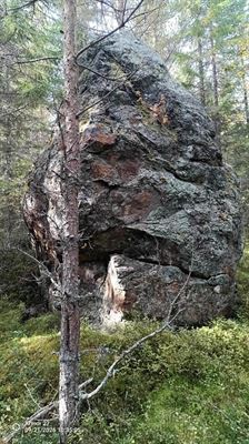
Gold-bearing boulders have driven exploration in the area for more than forty years, since Ingemar Åslund found the first, and over the years more than 50 gold-bearing boulders have been located in the area around Nya Gilleberget.
At the Enåsen mine in Ljusdal Municipality, Boliden mined about 400 kilograms of gold annually between 1984 and 1991.
The autumn drilling
All three holes, GB202605, GB202606 and GB202607, were drilled from the same site at different angles, so that at the depth where the zone was intersected they are calculated to pass between about 40 and 80 metres from GB202601. The programme totalled 845.1 metres, against the roughly 600 metres planned.
|
Drill hole |
Easting |
Northing |
Azimuth |
Dip |
Length |
|
GB202605 |
524 884 |
6 852 560 |
220° |
55° |
311.5 metres |
|
GB202606 |
524 884 |
6 852 560 |
250° |
50° |
242.8 metres |
|
GB202607 |
524 884 |
6 852 560 |
250° |
55° |
290.8 metres |
|
Total |
845.1 metres |
The coordinates are planned, in SWEREF 99 TM.
The mineralisation has been field logged continuously by the Company's geologist at the drill site, and with the last hole, completed on 5 October 2026, observations are available from all three holes. In GB202607 the three zones lie between 156.8 and 174.7 metres, 228.75 and 238.2 metres, and 271 and 281 metres down the hole. The lengths are down-hole lengths, and the true width (the actual thickness of the mineralisation) has not been determined. The distances are calculated from the planned direction and dip of the holes, and the intervals in the other two holes will be reported together with the assay results.
Comments
"This spring we got 28 metres of gold in a single hole. Now we have drilled three holes around that intersection, and we see mineralisation in all three, with three zones totalling 37 metres in the last. That is exactly what we wanted to see. Now I want the assays on the table, and we expect them before the end of the year."
Fredrik Johansson, CEO, Lappland Guldprospektering AB (publ)
"We have been exploring in the area since 1979, when the first boulder was found. What has made us and several other exploration companies so interested is the abundance of boulders with gold in them. Over the years we have located more than 50 boulders with gold in them, and I now think that after this summer's and autumn's drilling we can say that the source of the boulders has been found."
Torbjörn Grahn, Prospector, Lappland Guldprospektering AB (publ)
Next steps
The drill core is being transported to Malå, where the Company's geologist will log it in detail and describe rock types, structures and minerals. The logging is expected to take a couple of weeks and the assays about one month after that. The Company will report the assay results from all three holes when they are available.
This week the Company begins magnetometer surveys over the area where the mineralisation could reach the surface. A magnetometer measures the magnetic field, and the result is a map of magnetic anomalies, that is, places where the bedrock is more or less magnetic than its surroundings. The map will be used to target the next drilling.
Upcoming milestones
The Company's assessment at the time of this press release. The timing of the decision on the environmental permit is governed by the processing of the application, the decision itself and any appeals.
|
Milestone |
Timing |
|
Assay results from the autumn core drilling at Nya Gilleberget |
Fourth quarter of 2026 |
|
Continued core drilling at Stortjärnhobben |
Autumn 2026 |
|
Decision on the environmental permit for test mining at Stortjärnhobben |
Autumn 2026 |
|
Updated Mineral Resource for Stortjärnhobben |
Fourth quarter of 2026 |
|
Preliminary economic assessment for Stortjärnhobben |
Fourth quarter of 2026 |
|
Review of the historical drilling data at Gubbträsk and a decision on continued exploration |
Fourth quarter of 2026 |
|
Follow-up percussion drilling at Löparen on a tighter grid |
Winter 2026/2027 |
The Market Abuse Regulation
This information is information that Lappland Guldprospektering AB (publ) is obliged to make public pursuant to the EU Market Abuse Regulation (MAR). The information was submitted for publication, through the agency of the contact person set out below, on 6 October 2026 at 09:15 CEST.
For further information
Fredrik Johansson, CEO
Lappland Guldprospektering AB (publ)
Phone: +46 70 300 31 70
Email: fredrik.johansson@lapplandguld.se
Competent Person according to PERC
The zone in GB202601 belongs to the Company's Exploration Results and does not show that the gold can be mined profitably. The information on the zone has been reviewed and approved by Lazaros Dalampiras, MAusIMM CP(Geo), a Competent Person according to PERC. The visual observations in the autumn drill holes GB202605, GB202606 and GB202607 have not been reviewed by the Company's Competent Person, nor has the information on the boulders. The observations will be reviewed together with the assay results.
This press release is published simultaneously in Swedish and English. Swedish is the Company's main language for regulatory information and the English version is a translation.
Glossary
Core drilling. Drilling that recovers a continuous cylindrical rock core, so that grades can be tied to an exact depth.
Percussion drilling. Reconnaissance drilling in which the crushed cuttings are collected and assayed. A fast method for outlining anomalies, with lower resolution than core drilling.
Mineralisation. An enrichment of one or more minerals in the bedrock. In the autumn holes it consists of skarn with pyrrhotite, arsenopyrite and copper sulphide.
Boulder. A block of rock carried away from its origin in the bedrock by the inland ice. The position of the boulders and the direction of ice movement are used to trace where in the bedrock they come from.
Magnetic anomaly. A place where the bedrock is more or less magnetic than its surroundings. Here the gold-bearing boulders are strongly magnetic, and the survey looks for rock with the same property.
About the Company
Lappland Guldprospektering AB (publ) is a Swedish exploration company focused on gold in Sweden. The Company's main project is Stortjärnhobben in southern Lapland, for which an exploitation concession has been granted and where an Inferred Mineral Resource of 4.6 tonnes of gold has been reported in accordance with the PERC Reporting Standard¹.
In addition to Stortjärnhobben, the Company holds, directly and through its wholly owned subsidiary Svensk Malmprospektering AB, twelve exploration permits, all of which include gold among the minerals applied for and several of which also include lead, copper, silver and zinc. The Company is listed on the Spotlight Stock Market under the ticker LGOLD B, with its registered office in Stockholm and its head office in Skellefteå.
¹ PERC refers to the PERC Reporting Standard (2021 edition), the pan-European standard for the reporting of Mineral Resources and Mineral Reserves. The Inferred Mineral Resource at Stortjärnhobben amounts to 4.6 tonnes of gold in 2.65 million tonnes of rock at 1.73 grams of gold per tonne. Inferred means that quantity and grade are estimated with low geological confidence. Cut-off grade: 0.8 grams of gold per tonne. Top-cut for individual high grades: 20 grams of gold per tonne. The Stortjärnhobben Mineral Resource was reported by Lazaros Dalampiras, MAusIMM CP(Geo), Competent Person under PERC. It is not affected by this press release and stands unchanged until an updated estimate is published.